Tuesday, August 20, 2013

San Bernardino & Riverside Counties Thomas Guide 39th Edition Released!

The San Bernardino & Riverside County Thomas Guide 39th Edition (2013) has been released and is in stock now!


The 2013 San Bernardino & Riverside Counties Thomas Guide provides the most highly accurate, richly detailed mapping available for the area. Easy to navigate, contiguous street-level maps cover both San Bernardino & Riverside counties in their entirety, with a landscape-style layout and spiral binding for maximum convenience on the go. This San Bernardino county & Riverside county map book is a valuable tool for all commuters, planners, dispatchers, and people on the go!


San Bernardino & Riverside Thomas Guide Features:


  • Full coverage for all cities & communities
  • Easy-to-use Page & Grid System
  • Fully indexed points of interest


The San Bernardino & Riverside County Thomas Guide content has been fully updated, and includes hundreds of new streets and updates, San Bernardino & Riverside county ZIP codes, boundaries, and transit information, as well as a complete street index.


Hundreds of Communities Including:


Adelanto, Aguanga, Apple Valley, Banning, Barstow, Beaumont, Big Bear Lake, Capistrano, Cathedral City, Chino, Coachella, Colton, Corona, Desert Hot Springs, Hemet, Hesperia, Idyllwild, Indio, Irvine, La Quinta, Lake Arrowhead, Lake Elsinore, Menifee, Moreno Valley, Murrieta, Norco, Palm Springs, Perris, Pomona, Rancho Cucamonga, Redlands, Sage, San Bernardino, San Jacinto, San Juan, Santa Ana, Temecula, Twentynine Palms, Upland, Victorville, Wildomar, Winchester, Yucaipa, Yucca Valley, and neighboring communities.


  • Dimensions: 11" x 8.5"
  • Pages: Page Count TBD.
  • Scale: TBD.
  • Released July 30, 2013.


Check out our Custom Laminated Thomas Guide map books too! We do a Custom Laminated San Bernardino Thomas Guide and a Custom Laminated Riverside County thomas Guide for lasting durability and write on/wipe off convenience.

Visit our secure online map store at www.mapbooks4u.com for all of your needs! Map Books 4 U is your source for Thomas Guide map books!

Thursday, February 28, 2013

2013 Los Angeles & Orange Counties Thomas Guide 53rd Edition Available Now!


The Los Angeles & Orange County Thomas Guide 53rd Edition (2013) has been released and is in stock now!


The 2013 Los Angeles and Orange Counties Thomas Guide provides the most highly accurate, richly detailed mapping available for the area. Easy-to-read, contiguous street-level maps cover both Los Angeles and Orange counties in their entirety, with a landscape-style layout and spiral binding for maximum convenience on the go. This Los Angeles county & Orange county map book is a valuable tool for all commuters, planners, dispatchers, and people on the go!


Los Angeles & Orange Thomas Guide Features:


  • Full coverage for all cities & communities
  • Easy-to-use Page & Grid System
  • Fully indexed points of interest


The Los Angeles and Orange County Thomas Guide content has been fully updated, and includes hundreds of new streets and updates, Los Angeles & Orange county ZIP codes, boundaries, and transit information, as well as a complete street index.


More than 400 Communities Including:


Anaheim, Azusa, Beverly Hills, Burbank, Carson, Castaic, Costa Mesa, Dana Point, Diamond Bar, El Monte, Glendale, Hollywood, Huntington Beach, Irvine, Laguna Beach, Lakewood, Lancaster, Long Beach, Los Angeles, Malibu, Mission Viejo, Newport Beach, Orange, Palmdale, Pasadena, Pearblossom, Pomona, Rancho Palos Verdes, Reseda, San Fernando, San Juan Capistrano, San Onofre, Santa Ana, Santa Clarita, Studio City, Torrance, Valencia, Walnut, Whittier, and neighboring communities.


  • Dimensions: 11" x 8.5"
  • Pages: Page Count TBD.
  • Scale: TBD.
  • Released Feb 15, 2013.


Check out our laminated Thomas Guide map books too!

Wednesday, October 17, 2012

Compass Map Street and Road Atlases

As most of our Northern California customers are aware, Compass Map Company has been out of business since approximately 2007.

We have received so many calls for anything covering the following counties: Butte, Nevada-Sierra, Placer, Reno & Sparks, and Shasta that we have gone to great lengths to get our hands on every available copy for those areas.

We are thrilled to announce that we have obtained some of the older street and road atlases for these counties but they are in VERY limited availability and quantity. Some may have a little shelf wear on the covers but they are all unused map books. All sales are final on these map books.

You may see the Compass Street Atlases that are available here:

http://www.mapbooks4u.com/page/742309/


Compass Map Street and Road Atlases have many features, the most prominent of which is legibility. Each of the Compass Maps street atlas map books includes full coverage of all unincorporated county areas, as well as thorough indexing of all streets and points of interest.

These Northern California street atlases are easy to use and are a must-have reference tool for anyone who does extensive route driving in that region. **Compass Maps has gone out of business and the books here are in limited availability. The available Compass Maps Street Atlases shown are not returnable as these are close out items. Order your Compass Maps Street Atlas now before they are gone!

Thank you for choosing us!

Map Books 4 U

Thursday, July 19, 2012

Take the Time to Prepare for an Emergency!

It is that time again! Time to be prepared for an emergency! In April we experienced a power outage and cell phone outage here in Southern California that affected San Diego County, part of Riverside County, into Mexico and Arizona.

I was in Carlsbad at the time, having to travel back to Oceanside and watched the chaos that started to unfold...at first very slowly then quicker as the hours ticked by. Lines formed for gas which could not be pumped or paid for without electricity. Banks had to close for security and ATMs stopped working. Traffic lights were out, the 5 freeway started to back up and tempers were so short. Elevators were out and restaurants/bars got rid of what they could while food was hot, drinks were cold. The supermarkets had lines all the way around the building and store employees had to escort a patron one at a time with flashlight through the store to do their shopping and then calculate manually their items.

I'm not trying to freak anybody out, just trying to get the message across that I witnessed all of this first hand, not a scene out of a movie, and wondered if those affected that day would learn something and prepare ahead for the next emergency. Whether you experienced it or not, please prepare your home, your workplace, and your home. Get Disaster Certified and join your Citizen's Patrol for your local area. It would be a wonderful thing to show American True Grit the next time around whether it is a small emergency or a large disaster.

Westways Magazine put together a sort of "how to" on preparing your own Emergency Car Kit. Of course Map Books 4 U highly recommends that you have a Thomas Guide or a Rand McNally Easy-to-Fold Laminated Folded Map included for getting around in an emergency.

You will want to include pliers, an adustable wrench, a utility knife, a Phillips and a flat-head screwdriver, work gloves, antifreeze, a quart of oil, a Swiss Army Knife, weatherproof flashlight or one of those "shake" flashlights, wire cutters, bottle opener, (although you can use your screwdriver if need be), duct tape to make a temporary patch, a dry fire extinguisher, flares, and an ice scraper if you live where the weather is applicable. Reflective triangles are extremely handy for night time breakdowns or emergencies. A quality pair of jumper cables and a first aid kit are must haves.

Perfect additions to your emergency kit are Protein Bars, those small emergency blankets that can be bought in any camping or sport store, and a sealed jug of water. These items will not only help ease your mind in a breakdown but will be help you through a disaster. In California we have earthquakes that can really effect those that have long commutes between home and work. Carrying a Thomas Guide or laminated folded map is a tremendous help in getting you back to your loved ones when those main arteries, (our freeways), are clogged or closed.

Visit Map Books 4 U for discounted Thomas Guides, Road Atlases, Laminated Folded Maps, and Wall Maps.

Map Books 4 U!

Thursday, February 19, 2009

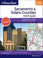
2 Sacramento & Solano Laminated Thomas Guides Left

Thomas Guide


Thomas Guide Sacramento County & Solano County Laminated: Including Portions of Placer and El Dorado Counties (Sacramento & Solano County, Including Portions of Placer and El Dorado Counties Street Guide and Directory)

The regular versions of these Thomas Guides have been discontinued and sold out! Once these are sold out only Solano County Thomas Guide Laminated will be left in stock with limited availability!

Wednesday, May 07, 2008

40 Southern CA High Schools to race Solar Powered Boats

LOS ANGELES-(BUSINESS WIRE)--WEEKEND ADVISORY FOR MAY 16-18


The Metropolitan Water District of Southern California:


WHAT:


Solar Cup competition in which teams of Southland high school
students race single-seat solar-powered sculls. Weekend attendance
numbers several thousand.

WHEN:


8 a.m. to 4 p.m. Friday, Saturday and Sunday May 16-18. Friday is
technical inspections, Saturday is endurance competition, Sunday is
sprint races and awards ceremony.

WHERE:


Lake Skinner; Riverside County Thomas Guide page 930, 4-D. Take I-15
to Rancho California Road, Temecula. Go northeast 10 miles to main
gate.

MEDIA OPPORTUNITIES:


Boats are colorfully painted or varnished for Hottest-Looking Boat trophy; teams often wear matching outfits. Student interviews on importance and fun of program. Student-made 30-second water-conservation videos. Reporters, photographers and camera crews can be taken onto the lake for competition close-ups. Reporters may pilot a solar-powered boat by prearrangement. Team interviews at launch ramp arranged for morning news programs as early as 6 a.m.


PARTICIPANTS:


Solar Cup teams from high schools in Anaheim, Banning, Burbank,
Camarillo, Chino Hills, Claremont, Covina, Diamond Bar, Downey, Duarte,
El Monte, Fullerton, Hacienda Heights, La Puente, La Verne, Lake
Elsinore, Lake Forest, Long Beach, Los Angeles, Menifee, Mira Loma,
Moreno Valley, Murrieta, Pomona, Rancho Cucamonga, Riverside, San
Bernardino, San Dimas, San Fernando, San Gabriel, San Jacinto, Temecula
and Upland, plus managers of Metropolitan Water Districts
Solar Cup program and the May 16-18 event.


Contacts


The Metropolitan Water District of Southern California

Rob Hallwachs, 213-217-6450
213-324-1255 mobile

Thursday, April 03, 2008

Thomas Guide Information cited from Wikipedia, the Free Encyclopedia

Looking into how others describe the Thomas Guide brought me some information that I thought might be interesting to share with others. On Wikipedia, the Free Encyclopedia...there is a description of the Thomas Guide that is sold at discounted prices on our online map store.

Here it is:

Cited here:

"Thomas Guide." Wikipedia, The Free Encyclopedia. 13 Feb 2008, 07:44 UTC. Wikimedia Foundation, Inc. 3 Apr 2008 .

Thomas Guide is the title of a series of paperback, spiral-bound atlases featuring detailed street maps of various large metropolitan areas in the United States, in the metro areas of Boise, Las Vegas, Los Angeles, Oakland, Phoenix, Portland, Reno-Tahoe, Sacramento, Salem, San Francisco, Seattle, Spokane, Tucson, and Washington, D.C.. Road Atlas titles are Arizona including Las Vegas, California Including portions of Nevada, and Pacific Northwest covering Washington, Oregon, Western Idaho, Southwestern British Columbia. The map books are usually arranged by county; for example, separate Thomas Guides have been published for Los Angeles County and San Diego County. There are also guides that will have two or three counties combined (for example, Los Angeles and Orange County), or guides that cover a metropolitan area (for instance, the San Francisco Bay Area). Each guide has a detailed index of streets and points of interest, as well as arterial maps for easy page location.

Thomas Bros. Maps, the publishers of the Thomas Guide, was started in Oakland, California in 1915 by cartographer George Coupland Thomas and his two brothers, who were business partners. The company relocated its headquarters to Los Angeles in 1940, and to suburban Irvine, California in the 1950s. George Coupland Thomas died in 1955 and the ownership of the company was transferred to his widow and the Thomas family. The company remained privately owned until it was purchased by and became a wholly owned subsidiary of Rand McNally & Co. in 1999. Updated editions are released annually. Folding map products are created as a derivative of the Thomas Guides, which carry the Rand McNally name, but mention that the content is from the Thomas Guides. Rand McNally also releases Thomas Guide-like Street Guides and traditional fold-out versions of maps covering regions of North America not covered by the Thomas Guides.

Thomas Guide atlases are often referred to colloquially as a Thomas Brothers (for Thomas Bros. Maps). They are so commonly used in Southern California that governments, businesses, individuals and even emergency response agencies will often refer to the page number and map grid to help specify a location.[1]

Businesses often use the large Thomas Guide wall maps. One common use for the wall maps is for delivery businesses, such as a local pizza restaurant. In addition, custom versions of the guides and wall maps are produced for businesses and governments that include such things as census tracts, locations of government facilities, watershed boundaries, and political boundaries.

There are also CD-ROM digital editions of the Thomas Guide atlases available (Microsoft Windows only). In addition, the Thomas Brothers digital database can be licensed to companies and governments to use as a base map for geographical information systems applications
.

We will continue to look for more indepth information that might be helpful to our customers and those wanting to know about this facinating map book.

Tuesday, April 01, 2008

SMUD unveils solar-powered hydrogen fuel cell vehicle fueling station

SMUD unveils solar-powered hydrogen fuel cell vehicle fueling station

Power from the sun fuels clean vehicles that emit only water from the tailpipe

The Sacramento Municipal Utility District (SMUD) steps into the future of automotive technology as it formally opens a solar-powered hydrogen fueling station for fuel-cell electric vehicles (FCEV). The station is a joint SMUD, BP, Ford and U.S. Department of Energy project to demonstrate FCEV’s and generation of hydrogen from renewable resources.

The station produces hydrogen onsite using power produced by a large solar array. The hydrogen will fuel SMUD FCEVs and others in the region. As the solar panels make electricity, an electrolyzer uses that energy to separate water into hydrogen to make clean fuel for the vehicles.

The project is the next step in a nearly two-decade long effort by SMUD to improve local air quality by advancing alternative fuel clean transportation as well as cleaner power sources. The solar array that powers the production of hydrogen at the station produces 80 kilowatts of electricity. This is equivalent to powering about 40 single-family homes or enough hydrogen for about 14 fuel-cell vehicles.

There will be a demonstration on Tuesday April 1, 2008 at 1:15 p.m. at 6101 S Street, just west of SMUD HQ building (Thomas Guide page 298 A-7). The demonstration will include a viewing of the Hydrogen fuel cell vehicle fuelling station covered by large solar panel array and numerous fuel cell vehicles. There will also be an opportunity to talk to experts from SMUD, BP hydrogen; Ford Motor Company FCEV and the U.S. Department of Energy.


Source: Fuel Cell Today

Saturday, March 01, 2008

Map Books 4 U Store and Site Directory

Map Books 4 U is a distributor of Thomas Bros. Maps and Rand McNally Company. We offer Thomas Guides, Laminated Thomas Guide map books, Rand McNally street guides, Road Atlases, and laminated EasyFinder or Easy-to-Fold maps.


Check out our site directory or store directory for the products you are interested in. You can also pick a map product category to visit.

Friday, February 29, 2008

Commercial Atlas & Marketing Guide * 2008 by Rand McNally


The Commercial Atlas & Marketing Guide by Rand McNally, is the first place to look for up-to-date business planning data! This 2008 Commercial Atlas & Marketing Guide is formatted into two easy to use volumes for your convenience.

One of the books in this Commercial Atlas & Marketing Guide set, is the guide and the other is the index. Inside you will find updated, detailed maps with the latest geographic data for more than 120,000 places in the U.S. Population and economic data is included as well - complete with large scaled detailed maps.

Thorough indexing makes for easy cross-referencing too. The Commercial Atlas & Marketing Guide is sure to give users that necessary statistical edge and is an essential tool for business success.

Buy this Rand McNally Atlas and all of the other Rand McNally Atlases that you want or need at Map Books 4 U at discounted prices.

Saturday, June 23, 2007

2008 Riverside Thomas Guide & San Bernardino Thomas Guide released!


Check out the new 2008 Riverside County Thomas Guide and 2008 San Bernardino Thomas Guide now in stock at discounted prices. Also a new portrait edition of these popular Thomas Guides called Easy-to-Read Riverside County Thomas Guide and Easy-to-Read San Bernardino County Thomas Guide with maps 20% larger for easier viewing.

Map Books 4 U is offering a 30% discount or more on the new Easy-to-Read editions to kick off their publication. Order yours today and start navigating your routes with those bigger maps!

Thursday, May 03, 2007

Solar Cup Preview: 41 High School Teams Gather Saturday for Boats’ Technical Inspections

We know many of our readers are interested in Current Events and Happenings around the Southern Californa area and we like to help promote those events. Here is an alert we received about the Solar Powered Boats event.


Map Books 4 U


Solar Cup Preview: 41 High School Teams Gather Saturday for Boats Technical Inspections


Inspection Precedes Qualifying Events at Lake Skinner


LOS ANGELES--(BUSINESS WIRE)--Metropolitan Water District of Southern California:


WHAT:


Forty-one Southland high school teams gather for technical inspection of their solar-powered boat entries in the three-day Solar Cup event later this month at Lake Skinner near Temecula. Boats will be inspected and weighed; skippers will be weighed and Red Cross swim-tested. Cal-Poly Pomona students and professors give teams technical advice.


WHEN:


8 a.m. to 2 p.m., Saturday, May 5

WHERE:


Three Valleys Municipal Water District, 1021 E Miramar Ave.,
Claremont. Los Angeles County Thomas Guide, page 571, 6-F.

VISUALS:


First public look at the engineering and decoration of the 41, 16-foot-long boats that will compete in 2007 Solar Cup. Boats' unique propeller and rudder configurations are unveiled. Many teams varnish the wooden hulls; others paint their boats elaborately. Students being weighed and given swim tests.

WHO:


Solar Cup teams from high schools in Anaheim, Banning, Camarillo, Chino Hills, Claremont, Covina, Diamond Bar, Downey, Duarte, El Monte, Fullerton, Hacienda Heights, La Puente, La Verne, Lake Elsinore, Lake Forest, Long Beach, Los Angeles, Menifee, Mira Loma, Montclair, Moreno Valley, Murrieta, Norco, Pomona, Rancho Cucamonga, Riverside, San Bernardino, San Dimas, San Fernando, San Gabriel, San Jacinto, Temecula and Upland; managers of Metropolitan Water District's Solar Cup program and May 18-20 event.


Contacts


Metropolitan
Rob Hallwachs, 213-217-6450; 213-324-1255 mobile


Friday, December 01, 2006

GPS Navigator by Rand McNally is here!

GPS Navigator Rand McNally GPS Navigation System

Map Books 4 U is proud to be one of the few approved and authorized distributors of Rand McNally' s GPS Navigator, a portable global positioning system utilizing Rand McNally' s 150 years of expertise and cutting edge technology.
The Rand McNally GPS Navigator is the only gps system available with both paper road maps and a portable navigation device. You get the big picture that a road atlas provides and turn-by-turn GPS navigation in one box.


GPS Navigator Rand McNally' s Portable Global Positioning System

Unique features:

  • Simple, intuitive, and easy-to-use gps system with preloaded maps of the United States, Canada, Puerto Rico, and the U.S. Virgin Islands for voice-guided door-to-door routing.

  • Portable and lightweight design that's a full inch thinner than many other GPS devices in its class, so it takes less space on the dashboard, in your purse or briefcase.

  • The Rand McNally Road Atlas and Travel Planner for a big picture overview of where you want to travel.

  • 26 Best of the Road™ trip itineraries by Rand McNally, with suggested attractions, restaurants, and shops selected by Rand McNally's award-winning editorial staff.


Product highlights:


  • Clear voice prompts tell you when to turn

  • Automatic rerouting if you miss a turn

  • "Detour" button to route around traffic jams

  • Bright 3.5" color touch screen with 2-D and 3-D modes

  • Day- and night-view map modes
  • Large keyboard for touch screen entry

  • "Go Home" button that directs the driver home from any location

  • Multistop route/trip planning and mileage calculator

  • Doubles as an MP3 player

  • Easy access to millions of points of interest including:

    • Food

    • Gas stations

    • Lodging

    • Banks and ATMs

    • Travel and shopping

    • Emergency services

    • Many others


Each box includes:


  • Rand McNally GPS Navigator

  • Rand McNally Road Atlas and Travel Planner

  • Memory card with full maps of the United States, Canada, Puerto Rico, and the U.S. Virgin Islands

  • Windshield mount*

  • Vehicle charger

  • Quick-start guide

  • USB connector cable

  • Software utilities

  • Documentation DVD


GPS product specifications:


  • Unit dimensions: 4.5" W x 3.2" H x 1.4" D

  • Weight: 7 oz. (approximately 0.5 lb.)

  • Display: 3.5" color TFT LCD, LED backlight, 320 x 240 pixels, 65K colors, QVGA resolution, and landscape view

  • Hardware buttons: on/off, volume control, destination menu access

  • Battery: Lithium ion battery

  • GPS receiver: SiRF Star III with 20 channels

  • Antenna: Built-in patch

  • PC compatible: USB cable

  • Languages: English, French, and Spanish


Product Documentation


*PLEASE NOTE: Some state laws prohibit drivers from using suction mounts on their windshields while operating motor vehicles. Rand McNally does not accept any responsibility for any fines, penalties, or damages that may be incurred as a result of using the suction mount.

Tuesday, November 28, 2006

New Washington Street Atlas Titles Added!

Check out the new Washington Street Atlas titles at Map Books 4 U:

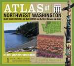
Atlas of Northwest Washington

  • Atlas of Northwest Washington: Covers these Washington State Counties: Island County, Skagit County, Whatcom County, San Juan County, plus the City of Stanwood & Vicinity.


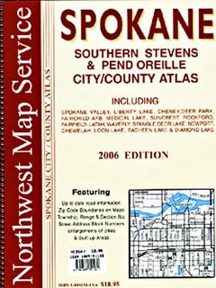
  • Spokane, South Stevens, & Pend Oreille City/County Street Atlas

  • Spokane, South Stevens, & Pend Oreille City/County Street Atlas: Covers these Washington areas: Cheney, Chewelah, Deer Lake, Deer Park, Diamond Lake, Fairchild AFB, Fairfield, Latah, Liberty Lake, Loon Lake, Medical Lake, Newport, Rockford, Sacheen Lake, Spangle, Spokane Valley, Suncrest, and Waverly.


  • Please visit Map Books 4 U for other titles. Don' t leave home without a print edition map or map book in case you have to change your route!

    Saturday, September 09, 2006

    2007 Thomas Guide Map Books

    Thomas Guide 2007 Books by Thomas Bros. Maps Available Now!


  • Northern California Thomas Guides


  • Southern California Thomas Guides


  • Arizona & Nevada Thomas Guides


  • *These editions contain details inside on how to receive your free cd from Rand McNally.

    **Buy your Thomas Guide from Map Books 4 U at a discounted price.

    Tuesday, July 11, 2006

    Check out the Harley-Davidson® Ride Atlas of North America by Rand McNally


    Rand McNally Introduces the Harley-Davidson(R) Ride Atlas Custom-Built for Motorcycle Riders


    Tuesday May 2, 8:58 am ET
    Ride Atlas of North America Features Select Harley-Davidson Rides, Exclusive Rand McNally Motorcycle Maps, Can't-Miss Stops and Rider Tips


    SKOKIE, Ill., May 2 /PRNewswire/ -- There are road trips and then there are rides. Rand McNally and Harley-Davidson know the difference: Cars take to the interstate for a road trip and bikers hit the back roads for a ride.


    For the millions of motorcycle enthusiasts looking for adventure, Rand McNally introduces the first-edition Harley-Davidson® Ride Atlas of North America. Packed with definitive maps of secondary roads, road construction information, local motorcycle laws and an expansive mileage directory, the compact 8.5-inch by 11-inch ride atlas fits snugly into a saddlebag. Wrapped in a black, rubber-like, touche cover are 284 pages of four-color maps, mileage charts, city indexes and descriptions of motorcyclist-tested rides in the United States.


    The Harley-Davidson Ride Atlas is packed with in-depth descriptions, custom trip maps and essential rider tips for 25 key rides nationwide. The scenic rides take motorcyclists off the beaten path -- to the coves, hollows and water gaps of North Carolina's Blue Ridge Parkway, through the towering oaks and cedars of Texas Hill Country, and past the emerald lakes and swift streams of the Cascade Range in northern California.


    Other unforgettable rides climb from the southern tip of Lake Superior toward the Canadian border along state Route 61, or hug the shoulders along the Chief Joseph Scenic Byway in Wyoming. Others meander through history along "The Trace" in the Land Between the Lakes in Kentucky and Tennessee. Still others cruise down a desert highway well-stocked with gas stations -- but no roadwork -- or crisscross the Rio Grande along the U.S.-Mexico border.


    Each ride features its own map highlighting the route, nearby points of interest and geographic features. The rides also include useful touring information, suggested side trips, best seasons to ride, gasoline availability, road conditions, Web sites and phone numbers for state tourism resources, and other insider tips.


    "We've enjoyed a long association with Harley-Davidson and were thrilled to partner with them on this exciting venture," said Laurie Borman, Rand McNally's editorial director. "For this book, we talked with Harley-Davidson riders about what they wanted and needed in a ride atlas and trip guide. The result -- the Harley-Davidson Ride Atlas of North America -- is the ultimate motorcycle enthusiast's book, incorporating the best of all the suggestions. Now motorcyclists have their own guide to know where to go, what to do, and how to get there and have fun doing it all."


    Packed with features that enhance the rider's experience


    "Our customers live for the time they spend out on the open road," said Tom Parsons, Harley-Davidson Acting General Manager of General Merchandise. "The all-in-one Ride Atlas features some of the most incredible rides in North America, hand-picked by Harley-Davidson and detailed by Rand McNally."


    In addition to ride maps, the Ride Atlas contains reliable, detailed Rand McNally maps of each U.S. state, major U.S. cities, Canada, Mexico and Puerto Rico. The maps are tailored to riders' needs, with the minor highways and secondary roads highlighted in bold color. The 25 featured rides and other scenic routes also are highlighted brightly.


    Each state map features listings, locations and phone numbers of Harley-Davidson dealerships, which also are indicated by symbols on the maps. Beside the maps are crucial state motorcycle laws and contacts for emergency roadside assistance, state motor vehicle information and tourism resources.


    The Ride Atlas also features detailed border crossing information for Mexico and Canada, contacts for U.S. state parks and profiles of America's 10 most popular national parks. A mileage and minutes guide provides driving distances and times between major U.S. cities. It also includes information on Harley-Davidson factory tours, Rider's Edge® -- The Harley-Davidson Academy of Motorcycling, Harley-Davidson Authorized Rentals, the Harley Owners Group® and motorcycle shipping. The Ride Atlas will be available in May 2006 at authorized Harley-Davidson® dealerships, randmcnally.com, select bookstores, select automotive stores, truck stops and military outlets.


    News Source: Rand McNally & Company


    Buy it now at Map Books 4 U for $34.95


    About Harley-Davidson

    Harley-Davidson Motor Company, the only major U.S.-based motorcycle manufacturer, produces heavyweight motorcycles and a complete line of motorcycle parts, accessories and general merchandise. For more information, visit Harley-Davidson's web site at http://www.harley-davidson.com .


    Wednesday, May 03, 2006

    El Dorado County Street Atlas and Road Atlas Now Available!


    The new 2006 El Dorado County Street Atlas by Compass has been released and is in stock now.

    This map book covering El Dorado County includes details for these communities:

    Placerville, South Lake Tahoe, Cameron Park, Camino, Coloma, Diamond Springs, El Dorado, El Dorado Hills, Georgetown, Meyers, and Pollock Pines.

    We carry other Northern California map books as well. You can find the Northern and Central California Thomas Guides here:

    http://www.mapbooks4u.com/page/150743

    and the other Northern California County map books by Compass here:

    http://www.mapbooks4u.com/page/742309/

    Lake Skinner to host 38 High School Teams Competing for the Solar Cup

    Released through BYM News

    MWD Solar Cup Regatta: 38 High school teams gather for technical boat inspections
    Tuesday, 02 May 2006
    Rob Hallwachs:


    Thirty-eight high school teams competing in May 19-21 Solar Cup at Lake Skinner present their solar-powered boats for technical inspection, skippers given swim tests between 8 a.m. to 3 p.m. Saturday, May 6 at Three Valleys Municipal Water District, 1021 E. Miramar Ave., Claremont. (Los Angeles County Thomas Guide page 571, F-5.)

    In the largest event of its kind in the nation, about 500 students from 38 schools are putting finishing touches on the solar-powered boats they've been building since December, preparing for the May 19-21 Solar Cup at Lake Skinner, Temecula. This inspection two weeks before event gives teams time to fix items that don't pass review.

    Schools from Anaheim, Camarillo, Chino Hills, Claremont, Covina, Diamond Bar, Downey, El Monte, El Toro, Glendale, Hacienda Heights, Indio, La Puente, Lawndale, Long Beach, Los Angeles, Mira Loma, Moreno Valley, Murietta, Norco, Fernando, San Gabriel, San Jacinto, Temecula, Upland and Whittier.

    Last Updated ( Tuesday, 02 May 2006 )


    Map Books 4 U supports various school districts and events throughout the U.S. If you have an event that you would like us to include, please contact us. If you can provide the map page and grid for the event location, it will greatly help prospective supporters.

    Wednesday, April 26, 2006

    Here is a kid that really deserves kudos!

    Geo Bee winner loves to explore the world

    By BARBARA NORDBY
    Star-Tribune staff writer

    From his family's house in the foothills near Casper Mountain, Jamie Mothersbaugh has a pretty good vantage point for learning about geography.

    He can see the North Platte River valley, the mountain top and the vastness of Wyoming stretching into the distance.

    But to win the National Geographic Bee next month, the 11-year-old with braces and shaggy blond hair will have to travel much farther.

    He'll go to Washington, D.C., May 22 and 23 as Wyoming's representative for his second shot at the national competition and will have to answer challenging questions about geography, history, climate and current events from around the globe.

    Jamie, a sixth-grader at Park Elementary School, won his school bee as a fourth-grader, and made it to the 2004 state Geo Bee.

    He can't remember the question he lost on, but hasn't forgotten everything: "The answer was Bhutan."

    The next year, as a fifth-grader, "I felt more confident about how I would do," he said.

    There are about 70 students at the state geography bee.

    Jamie beat them all, and went to D.C. in 2005.

    A group of supporters joined him: his teacher, Noreen Stutheit. His mom, Becky, the concertmaster of the Casper Symphony Orchestra. His dad, Jim, who teaches music at Park. His little brother, Blair, now in fourth grade at Park.

    The questions were hard. Jamie said he answered three of nine correctly in the preliminary round.

    On one question that tripped him up, he was shown three lakes and asked to put them in order by surface area.

    He learned that to do well at the national bee, he'd have to not only know a lot about the world, but be able to draw conclusions, make comparisons and really understand how different regions of the world depend on each other.

    Since he won the 2006 state bee last month, Jamie's been studying harder. He has a map of the world above his bed and a globe on his desk. He has a bookshelf full of atlases and study guides, and he watches world news at night.

    That is, whenever he's not doing his homework, playing baseball, hunting rabbits or practicing one of his three instruments: the violin, the trumpet and the piano.

    On the trip to D.C. last year, Jamie put together a thick scrapbook of his experience. He has postcards of the national monuments, pictures of himself with Sen. Craig Thomas, and his nametag from the Bee.

    His goal this year is to do better than last year. He's not scared. He likes the host, Alex Trebek.

    "He's not intimidating," Jamie said. "He's actually quite humorous."

    Winning may be a long shot: the bee is for students up to eighth grade. There will be kids from every state and some islands and territories.

    Jamie may have more chances to win in the next two years. By the time he's in eighth grade, he'll have logged a lot more miles in life.

    Since last year, he's done more traveling, going to New York and other states with his family last summer.

    He marveled at the Statue of Liberty, Fenway Park and other landmarks.

    "I think it's just interesting," he said, "that after having seen them in geography questions, and hearing about them on the news, then you can finally take all that and look at it."

    Reach Barbara Nordby at (307) 266-0633 or at barbara.nordby@casperstartribune.net.

    Wednesday, April 19, 2006

    A Metropolitan Water District Worthwhile Event

    April 17, 2006 07:23 PM US Eastern Timezone

    Saving Without Sacrificing: Homeowners in Riverside County Join Metropolitan, Shea Homes to Celebrate Living in Community Featuring the 'Gold Standard' in Water-Saving Features

    LOS ANGELES--(BUSINESS WIRE)--April 17, 2006--Metropolitan Water District of Southern California:
    WHAT: The first California Friendly(TM) homeowners gather for
    a spring event sponsored by Metropolitan Water District,
    Shea Homes and Eastern Municipal Water District
    celebrating their new homes and gardens that will use 50
    percent less water outdoors than traditional ones.

    WHEN: 10:30 a.m. to 1 p.m., Saturday, April 29

    WHERE: Watermill at Adeline's Farm, 32463 Spun Cotton Dr.,
    Winchester (Riverside County Thomas Guide, Page 929,
    E-1)

    WHO: Riverside County Supervisor Marion Ashley; Randy Record,
    Metropolitan Water District director representing
    Eastern Municipal Water District; Bob Yoder, president,
    Shea Homes-Inland Empire; representatives of the U.S.
    Bureau of Reclamation; and the new homeowners at
    Watermill at Adeline's Farm.

    BACKGROUND: New homeowners at Watermill at Adeline's Farm will offer
    their observations of what it's like to live in houses
    featuring the next evolution of water-saving features.
    Metropolitan's California Friendly landscape standards
    were developed in conjunction with several building
    industry organizations and the U.S. Bureau of
    Reclamation as a voluntary program to increase water use
    efficiency in new homes. These standards reduce water
    use by about 50 percent from a typical home landscape,
    and have been used by leading builders like Shea Homes.


    The Metropolitan Water District of Southern California is a cooperative of 26 cities and water agencies serving 18 million people in six counties. The district imports water from the Colorado River and Northern California to supplement local supplies, and helps its members to develop increased water conservation, recycling, storage and other water-management programs.

    Contacts
    Metropolitan Water District of Southern California
    Lynn Lipinski, 213-217-6603; 213-324-6430, mobile
    Bob Muir, 213-217-6930; 213-324-5213, mobile

    *As released on Business Wire

    Friday, March 10, 2006

    Road Runner Maps changes name to A Good Map Company, Inc.!

    Road Runner Maps makers of those wonderful Washington State County street atlases has formally changed it name to A Good Map Company, Inc.

    A Good Map Company, formerly Road Runner Maps, produces Street Atlases for the following counties in Washington State: Kitsap County, Jefferson County & Clallam County, Grays Harbor County, Mason County, Thurston County, and Lewis County.


    We carry the 2006 NEWLY released Road Runner Maps, now known as "A Good Map Company", street atlases in stock! A Good Map Company, while operating under the name of Road Runner Maps, also put together all seven counties into one convenient spiral bound street atlas and simply named it the Seven County Street Atlas!


    These Washington State county street atlases are spiral bound and have a page and grid system much like the King County, King & Pierce County, King & Snohomish County, and the King, Pierce, & Snohomish County Thomas Guide.


    While Road Runner Maps might have changed their company name to A Good Map Company, Inc., we still think they are really a great map company and we are proud to carry their whole line of street atlases!

    Saturday, November 26, 2005

    2006 Sacramento & Solano County Thomas Guide and 2006 Las Vegas & Clark County Thomas Guide Now in Stock!

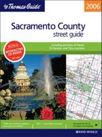
    Wow, Thomas Bros. Maps® has released some really popular updated editions this month. You can now purchase the 2006 Sacramento Thomas Guide with Cd-Rom Combo here:

    2006 Sacramento County Thomas Guide Book with Cd-Rom Combo
    Sacramento Thomas Guide - 2006


    the 2006 Sacramento & Solano County Thomas Guide with cd-rom combo here:

    2006 Sacramento and Solano County Thomas Guide with Cd
    Sacramento & Solano Thomas Guide - 2006


    and the 2006 Las Vegas & Clark County Thomas Guide with Cd-Rom combo here:

    2006 Las Vegas and Clark Thomas Guide with Cd Rom
    Las Vegas & Clark County Thomas Guide - 2006


    Map Books 4 U provides this information and the links to these Thomas Bros. Maps® products to help keep you updated!

    Saturday, October 01, 2005

    Phoenix Metro Thomas Guide & Tucson Metro Thomas Guide 2006

    The newly released 2006 Phoenix Metro Thomas Guide and the 2006 Tucson Metro Thomas Guide for Arizona, come with a free digital editon cd-rom. Thomas Bros. Maps has packaged them as book and cd combos to save the map users some serious money!

    You may purchase them here:

    2006 Phoenix Metro Thomas Guide with Cd
    Phoenix Metro Thomas Guide - 2006


    2006 Tucson Metro Thomas Guide with Cd
    Tucson Metro Thomas Guide - 2006


    Check back at our secure online map store Map Books 4 U for the most current Thomas Bros. Maps® Thomas Guide & Rand McNally Street Guide releases.

    Monday, September 12, 2005

    2006 Northern California Thomas Guides Released!

    Bay Area Metro Thomas Guide 2006 with Cd Rom Combo

    Thomas Bros. Maps, a Rand McNally Company, has released the 2006 editions of the following Thomas Guide Map Books:

    Alameda County Thomas Guide
    Alameda & Contra Costa County Thomas Guide
    Bay Area Metro Thomas Guide with Cd-Rom Combo
    Contra Costa County Thomas Guide
    San Francisco & Marin County Thomas Guide
    San Francisco & San Mateo County Thomas Guide
    Santa Clara County Thomas Guide
    Santa Clara & San Mateo County Thomas Guide

    You will find all of these Northern California Thomas Guide books in stock now at discounted prices!

    Each Thomas Guide title is available in a laminated version too. Laminated Thomas Guides make great gifts for anyone that uses their Thomas Guide on a daily basis.

    Thursday, August 18, 2005

    Road Runner Maps: Street Atlases Here!


    Road Runner Maps produces Street Atlases for the following counties in Washington State: Kitsap County, Jefferson County & Clallam County, Grays Harbor County, Mason County, Thurston County, and Lewis County.


    We carry the 2006 NEWLY released Road Runner Maps street atlases in stock! Road Runner also put together all seven counties into one convenient spiral bound street atlas and simply named it the Seven County Street Atlas!


    These Washington State county street atlases are spiral bound and have a page and grid system much like the King County, King & Pierce County, King & Snohomish County, and the King, Pierce, & Snohomish County Thomas Guide.


    Please be sure to stop by Map Books 4 U, your secure online map store source for Thomas Guide map books, Rand McNally Street Guides, Thomas Bros. Maps, Rand McNally, and Universal wall maps, EasyFinder Laminated Folded Maps, US Road Atlases, Motor Carriers' Road Atlases, Sagebrush Maps Street Atlases, and now Road Runner Maps Street Atlases!


    Tuesday, July 05, 2005

    Here is an article from the Press Enterprise in case you missed it!

    Inland-area growth tests mapmakers:
    2,700 Streets: Crews hit the road to verify recent updates and keep an eye out for future ones.


    02:07 AM PDT on Tuesday, July 5, 2005


    By DAN LEE / The Press-Enterprise

    Related
    Navteq Web site

    Mapquest Web site

    Patricia Jones and Greg Doughty looked around carefully as they drove across Alessandro Boulevard into Riverside from Moreno Valley.

    Wearing a headset with a microphone, Jones held the steering wheel with her left hand and a recording device shaped like a video-game controller in her lap with her right hand. Doughty took notes on a pen tablet connected to a laptop computer with a Global Positioning System unit.

    NEW STREETS

    The number of new streets, on average, that Thomas Guide is adding to its maps each year:

    Riverside County: 2,000

    San Bernardino County: 700 to 800

    Orange and Los Angeles counties: 400 to 600

    Source: Rand McNally


    Jones turned right onto Sycamore Canyon Boulevard and spied a network of industrial buildings on the west side of Interstate 215.

    "This all looks new here," she said.

    Jones and Doughty update street and landmark information for Navteq North America LLC, a mapping company that -- like local pizza parlors, police officers, firefighters, letter carriers and delivery services -- is trying to keep up with the Inland area's explosive growth.

    The populations of 27 Inland communities have grown at a double-digit pace during the past five years, with Murrieta nearly doubling its population in that time, according to state Department of Finance statistics. That means more new homes and more new streets that businesses and public-safety agencies have to map and identify.

    "We are putting in more time in making maps for the two counties," Rand McNally Vice President Nancy Yoho said by phone.

    Rand McNally, which publishes the Thomas Guide map books, has added an average of 2,000 streets per year in Riverside County over the past four years, she said. Meanwhile, San Bernardino County is adding about 700 to 800 new streets a year, Yoho said.


    Carrie Rosema / The Press-Enterprise
    Mark Kepler knows his way around his new Riverside neighborhood, but delivery people still don't. "Even the gas man got lost," he said.


    By contrast, the number of streets in Los Angeles and Orange counties grows by 400 to 600 a year, Yoho said.

    Mark Kepler is one of several homeowners in a new Riverside neighborhood who described early struggles in directing pizza deliveries, utility workers and others to their recently built Orangecrest homes.

    "That's been a major hassle," said Kepler, 29. "You definitely can't order out unless they are calling you every two or three blocks for directions. Even the gas man got lost."

    Neighbor Charles Monroe said when he called the Riverside police last week to report a swarm of bees in his back yard, the dispatcher asked for his cross street. A county crew sent to take care of the stinging insects had trouble finding the new house.

    "I had to talk them in," said Monroe, 52, describing how the crew trying to locate the home called him by cellular telephone for help.

    Public Safety

    Police officers, firefighters and ambulance-service providers are continually updating their maps, because they know that lives can be lost if they are unable to find a house.

    In fast-growing High Desert city of Apple Valley in San Bernardino County, for example, the Apple Valley Fire Protection District is among the agencies that helps review and approve tract maps, giving fire officials early access to the plans.

    The information is loaded into the fire department's computerized mapping program, allowing updates to be made in the map books carried in each fire engine.

    "I normally have the (new) map pages in the books before they break ground," Division Chief Art Bishop said.

    The American Medical Response ambulance company has its own computer-aided dispatch system that is regularly updated by Thomas Guide maps, said Bruce Barton, the company's Riverside County operations director.

    "If we get into a response where we don't have good information, we will communicate with the local public (safety) agency and get advance instructions," Barton said by phone.

    The ambulance crews also regularly spend time familiarizing themselves with the area, Barton said.

    Mail and Shipping

    The U.S. Postal Service reviews new street names to ensure that they aren't too similar to those of existing streets, Moreno Valley Postmaster Pete Weaver said by phone.

    "Then we plan for the number of deliveries that development is going to require," he said.

    Every route has a number of delivery points, Weaver said. An apartment complex that has a mailbox area would be a single delivery point, he explained.

    Most new housing tracts put multiple mailboxes in one curbside spot, Weaver said. Moreno Valley has added 3,799 delivery points since the same period last year, he said.

    That's the equivalent of nearly seven new routes, Postal Service spokesman Mike Cannone said by phone. Ordinarily, a post office picks up a new route every one or two years, he said.

    Murrieta has added 3,541 delivery points in the past year, while Temecula has slowed down, adding only 525 new delivery points, Cannone said.

    "That was our biggest growth area," he said.

    Apple Valley in San Bernardino County added 478 delivery points, but Victorville and Fontana each gained more than 1,000, Cannone said.

    Delivery companies such as United Parcel Service get their information on new streets from their drivers.

    "The minute they see a housing tract going in, they make contact with the developer, and they get maps of the new streets," Rich Day, UPS' Ontario-based spokesman, said by phone.

    UPS drivers also have computerized clipboards with GPS technology that have information on their delivery stops, he said.

    "Their whole dispatch is downloaded into their board. Here are how many stops they have today. Here are the addresses," Day said. "Run it on the board, and they should have no problem ... (the stops) will fall in one after the other."

    Thomas Guide vs. Mapquest

    Rand McNally relies on new tract maps filed with local agencies, and updated information on new parks, schools, hospitals and fire stations and revised city boundaries comes from other local officials, she said.

    Although the company has not hired more staff, its team of 60 cartographers is working additional hours to keep up with the rapid changes in Riverside and San Bernardino counties, Yoho said.

    In today's digital age, more people are making use of Internet map services such as Mapquest to find places and get directions. But Mapquest itself relies on companies such as Navteq, which collect and sell the information, company spokesman Brian Hoyt said by phone.

    Jones and Doughty drive out from their Upland office across the Inland area, taking notes on everything from speed limits and block numbers to how many lanes a street has and whether U-turns are permitted. The information helps calculate travel times, directions and distances for clients such as Mapquest, Jones said.

    One difference between Thomas Guide and Mapquest: Thomas Guide's map books are published only once a year, Yoho said; Mapquest may get information updates twice a year, according to Hoyt.

    Still, Yoho said she isn't worried about Internet services like Mapquest cutting into Rand McNally's business.

    Real estate firms, delivery services and public-safety agencies still rely on Thomas Guide's map books, she said.

    "From the things I've also heard, the Internet isn't all that reliable," Yoho said. "People will tell me, 'It's led me in the wrong direction or the long way around.' "

    Mapquest's Hoyt said mistakes happen, but they are rare.

    Nicholas Batshon, owner of Papa Joe's Pizza in Moreno Valley, said his employees use Mapquest to find delivery addresses and have never had a problem. If all else fails, they call the customer for directions, he said.

    Dave Hoover owns Lorenzo's Pizza, another Moreno Valley restaurant. The pizza parlor makes 50 to 100 deliveries a day, and the delivery drivers generally rely on the Thomas Guide's maps, he said.

    The drivers rely on their own knowledge if the Thomas guides aren't up-to-date, Hoover added.

    Most of the drivers grew up in the area, he said, "so they know where it's probably at."

    Staff writers Mike Fisher and Richard Brooks contributed to this report

    Tuesday, June 21, 2005

    2006 San Bernardino & Riverside County Thomas Guides Available Now!

    Thomas Bros. Maps, (owned and operated by Rand McNally Company), has released the 2006 edition of Riverside County Thomas Guide, San Bernardino County Thomas Guide, and the San Bernardino & Riverside Thomas Guide w/Cd-Rom Combo, California Thomas Guides. You will find these Thomas Guides in stock now!

    Each of these Thomas Guide map book titles is available in a laminated version. Laminated Thomas Guides make great gifts for anyone that uses their Thomas Guide on a daily basis. Graduation gifts, Mothers' and Fathers' Day, Birthdays, employee appreciation, and Christmas gifts for the person who has everything. We have had automobile dealerships purchase them to give away to customers that test drive their vehicles, and real estate agents that purchase them to give to their clients when they purchase a home. (Nice way for the client to get to know their new neighborhood!)

    The 2006 San Bernardino & Riverside County Thomas Guide has 4,597 new streets and updates since the 2005 edition.

    Map Books 4 U offers special discounts to all military, government agencies: city, county, state & federal, civil servants, and companies ordering in quantity. We accept purchase orders, checks, money orders, Visa, MasterCard, American Express, and the Discover Card.

    Map Books 4 U carries Thomas Guides, Rand McNally road atlases and Motor Carriers, (trucker's) Road Atlases, street guides, Cd-Roms, and city, county, state wall maps, as well as international, world, and US wall maps. We have laminated folded maps by Rand McNally called EasyFinders that are so convenient and durable. Call, email, or visit our secure online store for your map needs and map products.

    Thursday, June 16, 2005

    California: Riverside County - Whole Lotta Shakin' Goin' On!

    This afternoon Map Books 4 U as well as all other Riverside county businesses and residents experienced a sizeable earthquake that seemed to last for a more than a few moments.

    Here at Map Books 4 U, located in Nuevo, California, it seemed that we could "hear" the earthquake as it made its way through town. With the two or three aftershocks being very similar but much milder.

    We have posted these two maps showing earthquake activity locally and worldwide. The USGS posts current and past earthquake activity for the public. We have find some very valuable information on the USGS website concerning our earthquake activity and would like to provide the link for you:
    USGS Bulletin/